MAKE A MEME
View Large Image

| View Original: | Inner_Basin_Trail_No._29.jpg (4687x3125) | |||
| Download: | Original | Medium | Small | Thumb |
| Courtesy of: | www.flickr.com | More Like This | ||
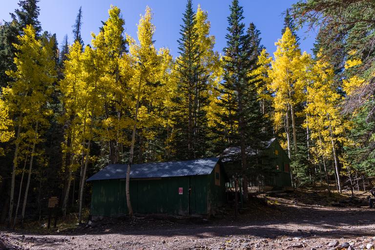
| Keywords: arizona coconino national forest coconinonationalforest flagstaff ranger district flagstaffrangerdistrict forest service forestservice inner basin trail innerbasintrail inner basin trail no. 29 innerbasintrailno29 national forest nationalforest pentax k-1 pentaxk1 san francisco mountain sanfranciscomountain san francisco peaks sanfranciscopeaks usfs aspen aspens fall color fallcolor fall colors fallcolors fall foliage fallfoliage flagstaff forest hiking outdoors trail united states unitedstates outdoor foliage plant Fall color on Inner Basin Trail along the Waterline Road section of the trail at Jack Smith Spring, October 5, 2016. The spring is tapped with a spigot in front of the snow shelter buildings. From here, Inner Basin Trail splits off from Waterline Road and heads up into the Inner Basin. The last half mile is the steepest part of the trail, but well worth the magnificent reward of reaching the pumphouse and spectacular view of the San Francisco Peaks from the caldera of this extinct volcano. Most trees are peaking or approaching peak color all along the Inner Basin Trail. Trees are approaching or at peak on the lower on Inner Basin Trail and in Lockett Meadow. A majority of the trees are at peak or past peak (and dropping leaves) on the upper part of the trail above Jack Smith Spring and in the Inner Basin. The Inner Basin Trail ascends from Lockett Meadow into the caldera of the San Francisco Peaks, an extinct volcano and home of the tallest peaks in Arizona. The first 1.7 miles of the trail winds through the extensive aspen forest flanking the upper reaches of the Peaks, joining the Waterline Trail briefly before following a jeep road into the caldera. The trail starts at an elevation of 8665 feet, gaining approximately 1200 feet over 2 miles on its way into the Inner Basin. The trail continues another 2 miles, gaining an additional 600 feet or so to join up with the Weatherford Trail. Photo by Deborah Lee Soltesz, October 5, 2016. Source: U.S. Forest Service, Coconino National Forest. See Lockett Meadow Campground and Inner Basin No. 29 for information about this area of the Peaks on the Coconino National Forest website. Fall color on Inner Basin Trail along the Waterline Road section of the trail at Jack Smith Spring, October 5, 2016. The spring is tapped with a spigot in front of the snow shelter buildings. From here, Inner Basin Trail splits off from Waterline Road and heads up into the Inner Basin. The last half mile is the steepest part of the trail, but well worth the magnificent reward of reaching the pumphouse and spectacular view of the San Francisco Peaks from the caldera of this extinct volcano. Most trees are peaking or approaching peak color all along the Inner Basin Trail. Trees are approaching or at peak on the lower on Inner Basin Trail and in Lockett Meadow. A majority of the trees are at peak or past peak (and dropping leaves) on the upper part of the trail above Jack Smith Spring and in the Inner Basin. The Inner Basin Trail ascends from Lockett Meadow into the caldera of the San Francisco Peaks, an extinct volcano and home of the tallest peaks in Arizona. The first 1.7 miles of the trail winds through the extensive aspen forest flanking the upper reaches of the Peaks, joining the Waterline Trail briefly before following a jeep road into the caldera. The trail starts at an elevation of 8665 feet, gaining approximately 1200 feet over 2 miles on its way into the Inner Basin. The trail continues another 2 miles, gaining an additional 600 feet or so to join up with the Weatherford Trail. Photo by Deborah Lee Soltesz, October 5, 2016. Source: U.S. Forest Service, Coconino National Forest. See Lockett Meadow Campground and Inner Basin No. 29 for information about this area of the Peaks on the Coconino National Forest website. | ||||