MAKE A MEME
View Large Image
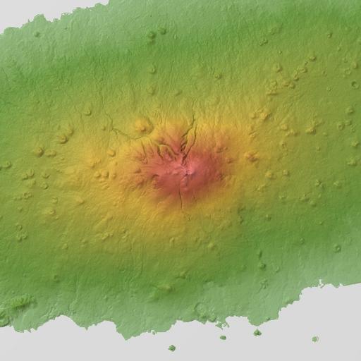
| View Original: | Jeju Island, Hallasan. Relief Map. SRTM-1 Ver3.jpg (800x800) | |||
| Download: | Original | Medium | Small | Thumb |
| Courtesy of: | commons.wikimedia.org | More Like This | ||
| Keywords: Jeju Island, Hallasan. Relief Map. SRTM-1 Ver3.jpg Relief map of Hallasan Jeju Island Korea From SRTM-1 Ver 3 2014 大韓民国の済州島� �漢拏山の陰影段彩図� � スペースシャトル� �形データ SRTM-1 Ver 3 2014 を使用� �レン� リングソフトはカシミール3D� � NASA's http //www2 jpl nasa gov/srtm/ Shuttle Radar Topography Mission Batholith Wikimedia Commons <br />Batholith Wikipedia 2016 2 28 PD-USGov-NASA-SRTM Topographic maps of South Korea Geography of Jeju-do | ||||