MAKE A MEME
View Large Image

| View Original: | The_Quarterly_journal_of_the_Geological_Society_of_London_(12961444804).jpg (1185x2056) | |||
| Download: | Original | Medium | Small | Thumb |
| Courtesy of: | commons.wikimedia.org | More Like This | ||
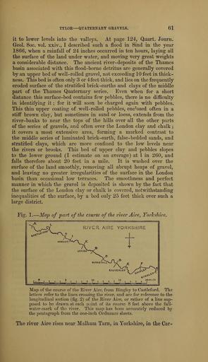
| Keywords: The Quarterly journal of the Geological Society of London (12961444804).jpg TTLOE � QTJATEBN-AEY aElVELS <br> 61 <br> it to lower levels into the valleys At page 124 Quart Jonrn <br> Geol Soc vol xxiv I described snch a flood in Sind in the year <br> 1866 when a rainfall of 24 inches occurred in ten honrs laying all <br> the surface of the land under water and moving very great weights <br> a considerable distance The ancient river- deposits of the Thames <br> basin associated with this flood-borne detritus are generally covered <br> by an upper bed of well-rolled gravel not exceeding 10 feet in thick- <br> ness This bed is often only 3 or 4feet thick and lies on the frequently <br> eroded surface of the stratified brick-earths and clays of the middle <br> part of the Thames Quaternary series Even when for a short <br> distance this surface-bed contains few pebbles there is no difficulty <br> in identifying it ; for it will soon be charged again with pebbles <br> This thin upper coating of well-rolled pebbles enc ' osed often in a <br> stiff brown clay but sometimes in sand or loess extends from the <br> river-banks to near the tops of the hills over all the other parts <br> of the series of gravels and often over the London clay and chalk ; <br> it covers a most extensive area forming a marked contrast to <br> the middle series of laminated brick-earth false-bedded sands and <br> stratified clays which are more confined to the low levels near <br> the rivers or brooks This bed of upper clay and pebbles slopes <br> to the lower ground I estimate on an average at I in 260 and <br> falls therefore about 20 feet in a mile It is washed over the <br> surface of the land smoothly removing all abrupt heaps of gravel <br> and leaving no greater irregularities of the surface in the London <br> basin than occasional low terraces The smoothness and perfect <br> manner in wliich the gravel is deposited is shown by the fact that <br> the surface of the London clay or chalk is covered notwithstanding <br> inequalities of the surface by a bed only 25 feet thick over such a <br> laro-e district <br> Fig 1 � Map of part of the course of the river Aire Yorlcshire <br> RIVER AIRE YORKSHIRE <br> Map of the course of the E-iver Aire from Bindley to Castleford The <br> letters refer to the hnes crossing the river and are for refei ence to the <br> longitudinal section fig 2 of the River Aire or rather of a line sup- <br> posed to be drawn at each point of its course 8 feet above the full- <br> water-mark of tli3 river This map has been accurately reduced by <br> the pentagraph from the one-inch Ordnance sheets <br> The river Aire rises near Malham Tarn in Yorkshire in the Car- 36102906 111288 51125 Page 61 Text v 25 http //www biodiversitylibrary org/page/36102906 1869 Geological Society of London Biodiversity Heritage Library The Quarterly journal of the Geological Society of London v 25 1869 Geology Periodicals Smithsonian Libraries bhl page 36102906 dc identifier http //biodiversitylibrary org/page/36102906 smithsonian libraries Information field Flickr posted date ISOdate 2014-03-06 Check categories 2015 August 26 CC-BY-2 0 BioDivLibrary https //flickr com/photos/61021753 N02/12961444804 2015-08-26 15 51 53 cc-by-2 0 PD-old-70-1923 The Quarterly journal of the Geological Society of London 1869 Photos uploaded from Flickr by Fæ using a script | ||||