MAKE A MEME
View Large Image

| View Original: | The_Quarterly_journal_of_the_Geological_Society_of_London_(12646279634).jpg (1225x2046) | |||
| Download: | Original | Medium | Small | Thumb |
| Courtesy of: | commons.wikimedia.org | More Like This | ||
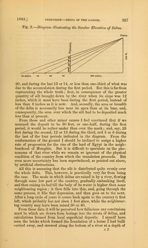
| Keywords: The Quarterly journal of the Geological Society of London (12646279634).jpg 1863 FERGUSSON DELTA OF THE GANGES 327 <br> Fig 2 � Diagram illustrating the Secular Elevation of Deltas <br> Patna <br> 50 miles <br> 200 miles <br> 20 and during the last 13 or 14 or less than one-third of what was <br> due to the accumulation during the first period But this is far from <br> representing the whole truth ; first in consequence of the greater <br> quantity of silt brought down by the river when its slope was 12 <br> inches which it must have been during the first period instead of <br> less than 6 inches as it is now And secondly the area or breadth <br> of the delta is necessarily less near its apex than at its base and <br> consequently the area over which the silt had to be deposited much <br> less than at present <br> From these and other minor causes I feel convinced that if we <br> assumed the deposit to be 50 feet or one-half during the first <br> period it would be rather under than over the mark ; and say 25 <br> feet during the second 12 or 13 during the third and 5 or 6 during <br> the last of the four periods indicated in the diagram From the <br> conformation of the ground I should be inclined to assign a higher <br> rate of progression for the rise of the land of Egypt in the neigh- <br> bourhood of Memphis But it is difficult to speculate on the phe- <br> nomena of that river while we remain so ignorant of the physical <br> condition of the country from which the inundation proceeds But <br> even more uncertainty has been superinduced as pointed out above; <br> by artificial obstructions <br> All this is assuming that the silt is distributed quite evenly over <br> the whole delta This however is practically very far from being <br> the case The mode in which deltas are raised is by a river flowing <br> through some low part of the country gradually embanking itself <br> and then raising its bed till the body of its water is higher than some <br> neighbouring region ; it then falls into this and going through the <br> same process it fills that depression and then goes on to the next <br> After a long cycle of years it comes back again to the country it first <br> left which probably has not risen 1 foot since while the neighbour- <br> ing country may have been raised 30 or 40 <br> From these data it will be perceived how fallacious any conclusions <br> must be which are drawn from borings into the strata of deltas and <br> calculations formed from local superficial deposits I myself have <br> seen the bricks which formed the foundation of a house I had built <br> carried away and strewed along the bottom of a river at a depth of <br> z2 35328298 109632 51125 Page 327 Text v 19 http //www biodiversitylibrary org/page/35328298 1863 Geological Society of London Biodiversity Heritage Library The Quarterly journal of the Geological Society of London v 19 1863 Geology Periodicals Smithsonian Libraries bhl page 35328298 dc identifier http //biodiversitylibrary org/page/35328298 smithsonian libraries Information field Flickr posted date ISOdate 2014-02-20 Check categories 2015 August 26 CC-BY-2 0 BioDivLibrary https //flickr com/photos/61021753 N02/12646279634 2015-08-27 11 58 07 cc-by-2 0 PD-old-70-1923 The Quarterly journal of the Geological Society of London 1863 Photos uploaded from Flickr by Fæ using a script | ||||